Surveying the American West
From Scienticity
Before expansion could properly take place, the new nation of the United States of America needed to understand what lay in the blank space to the West--called "unexplored territory" on maps published in the late 19th century. The answer was to conduct surveys and make maps.
Contents |
Surveying The National Territory
From 1800 to 1818, much of the mapping of the national territory was undertaken by the military on an informal, ad hoc basis, concerned in the main with basic exploration and national land claims. The resulting maps were essentially claims to territory. Federal mapping was a spasmodic affair. Survey teams were sent out on an irregular basis with differing aims, methods, and agendas. The most famous is the Lewis and Clark expedition.
In 1838 the Army Corps of Topographical Engineers was established by Congress and charged with the exploration and development of the continent and the construction of a scientific inventory of the land, with particular attention to the problems of transportation. For the remainder of the 19th century, the mapping of the West remained intimately connected with military control, investment opportunities, and transport improvements. John Charles Fremont led three major surveys in 1842, 1843, and 1845 to the Rocky Mountain, Oregon, and California. The United States and Mexico Boundary Survey was undertaken between 1848 and 1853, and utilized the skills of geologists, botanists, surveyors, and naturalists.
In March 1853, Congress authorized a government survey of all principal rail routes. The Corps of Topographical Engineers was instructed to find the most sensible railroad route from the Mississippi to the Pacific. The survey came under the control of the Secretary of War, Jefferson Davis, who sent out four main parties: a northern survey concentrating on the 47th and 49th parallels; a survey of the 38th parallel; and two surveys along the 35th parallel--one from the west and one from the east. The result was a widening of botanical, zoological, and geological knowledge, and the creation of a detailed topography of the West.
The Great Surveys

The mapping of the new continent was interrupted by the Civil War (1861--65). After the war, the federal government undertook further surveys of the West that were to set new standards of mapping and result in the formation of the United States Geological Survey. Four large surveys were funded by Congress and are commonly named after their principal leaders (King, Wheeler, Hayden, and Powell). The journalistic reporting and artistic illustration of these great surveys were reproduced in the expanding magazine and book trade, and greatly influenced Americans' perception of the West.
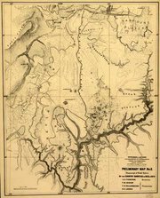
Clarence King (1842--1901) led his survey along the 40th parallel between 1863 and 1873, covering a large area and focusing primarily on the geological structure of the land. The Wheeler Survey, led by Lieutenant George Wheeler (1842--1905), covered a huge area over the period 1863--73, including California, Colorado, Montana, Idaho, Nebraska, Nevada, New Mexico, Utah, and Wyoming. Wheeler produced the first contour maps of the region and also produced 27 land classification maps that showed the different types of land use.
Ferdinand Hayden (1829--87) also led his expedition into Colorado (1873--76). He was a geologist whose scientific surveys provided valuable data on the geology, botany, and zoology of the West. Hayden felt that his primary responsibility was to publicize and promote the West. His reports and maps helped to bring the grandeur of the Rocky Mountains and the Yellowstone region to wider public attention.
John Wesley Powell (1834--1902) undertook two surveys, beginning in 1869 when he traveled down the Colorado River. In 1871 Powell set out again, with federal backing, north of the Grand Canyon. In 1878, he published his report on The Arid Regions of The United States. Thus, by the end of the 1870's, the West had been comprehensively explored, mapped, described, and classified.
Source
Excerpted from John Rennie Short, The World through Maps: A History of Cartography (Buffalo [New York]: Firefly Books, 2003), pp. 158--160.
Special Copyright Notice
The material on this page is Copyright © 2003 Andromeda Oxford Ltd and may not be reproduced without permission; it is used here at Scienticity by permission of the author, John Rennie Short.
